Gwaith Ellis Pritchard
| Location | SH664428 |
|---|---|
| Parish | Llan Ffestiniog |
| Production and Employment | |
| Owners | Ellis Pritchard ? |
| Transport | |
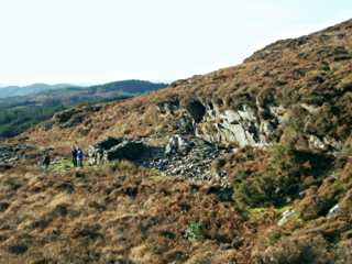
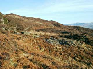
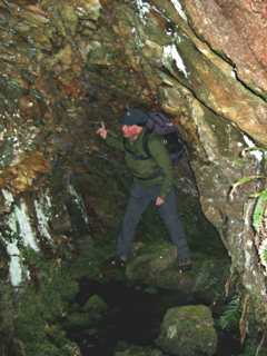
| Remains | Workings along base of small cliff for about 45 m. Small underground working about 4 m long aligned to base of cliff, two water-filled pits of unknown depth (more than 1 m deep – possibly flooded shafts), walled up waste, dressing floor or ore stacking platform, tips and small (aprox 2.5 m x 2 m internal dimensions) shelter with small window opening, fireplace in corner and niches in wall. (December 2003) |
This is recorded as a manganese mine [GAT SMR: 20781], however Harold Morris [Morris, Harold 2008, Pers. Comm.] reports that he has found galena on the tip and is of the opinion that it was a lead mine.
The workings are not shown on the 1899 revision of the 6" map [OS 2nd edn: XI NE]