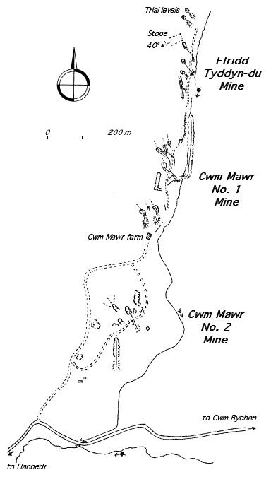
Cwm Mawr No. 1
| Alternative names | Nant Steicyn Cwm Mawr & Nant Steicyn Cambrian ? [GAT SMR: 21749] |
||||||||||||||||||||||||||||||||||||||||||||||||||||||||||||||||||||||||||||||||||||||||
|---|---|---|---|---|---|---|---|---|---|---|---|---|---|---|---|---|---|---|---|---|---|---|---|---|---|---|---|---|---|---|---|---|---|---|---|---|---|---|---|---|---|---|---|---|---|---|---|---|---|---|---|---|---|---|---|---|---|---|---|---|---|---|---|---|---|---|---|---|---|---|---|---|---|---|---|---|---|---|---|---|---|---|---|---|---|---|---|---|---|
| Location | SH635322 (Area map showing location.) | ||||||||||||||||||||||||||||||||||||||||||||||||||||||||||||||||||||||||||||||||||||||||
| Parish | Llanfair | ||||||||||||||||||||||||||||||||||||||||||||||||||||||||||||||||||||||||||||||||||||||||
| Geology | The outcrop runs from near Llyn Cwm Bychan for almost 2.4km. The bed dips to the west and is at times much crumpled. At the northern extremity of the outcrop (1.2km north of the farm) it is cut off by a fault. North of the farm the bed is about .36 m wide and much shattered, dipping at up to 40° in places. Near the farm the vein is described as being about .46 m wide but very hard. The worked-out surface part of the outcrop was soft earthy manganese oxide. [Dewey & Bromehead 1915: 52] | ||||||||||||||||||||||||||||||||||||||||||||||||||||||||||||||||||||||||||||||||||||||||
| Owners |
|
||||||||||||||||||||||||||||||||||||||||||||||||||||||||||||||||||||||||||||||||||||||||
| Production and Employment |
|
||||||||||||||||||||||||||||||||||||||||||||||||||||||||||||||||||||||||||||||||||||||||
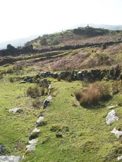
| Transport | Presumed cartage to Llanbedr station. A track can be traced for most of the extent of the mines north of the farm house. | ||||||||||||||||||||||||||||||||||||||||||||||||||||||||||||||||||||||||||||||||||||||||
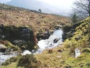
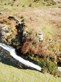
| Remains | Adits and loading bank to north of farm at SH63413202 there are workings on either side of river north of the farm. (March 2005) | ||||||||||||||||||||||||||||||||||||||||||||||||||||||||||||||||||||||||||||||||||||||||
The workings on the east side of the river pre-date those on the west side (see picture below).
From 21 July to 13 October 1905, about 30 tons of manganese at Cwm Mawr were offered for sale by auction [Cambrian News 21/7/1905 p. 1 and subsequent issues].
The adits by the farm were opened (presumably by Turner) in 1907–1908 [Dewey & Bromehead 1915: 52]. In March 1907 Edward Williams was injured by a fall of loose rock [North Wales Express 11/10/1907 p. 6].
Described as “idle” in 1923 [Dewey & Dines 1923: 65].
See also Cwm Mawr No 2 and Cambrian