Mynydd Nodol
| Alternative name | Manganese Royal Royal Manganese [Wilkinson 2003: 14423] Great Northern |
||||||||||||||||||||||||||||||||||||||||||||||||
|---|---|---|---|---|---|---|---|---|---|---|---|---|---|---|---|---|---|---|---|---|---|---|---|---|---|---|---|---|---|---|---|---|---|---|---|---|---|---|---|---|---|---|---|---|---|---|---|---|---|
| Location | SH859391 to SH865399 (Area map showing location.) | ||||||||||||||||||||||||||||||||||||||||||||||||
| Parish | Llanycil | ||||||||||||||||||||||||||||||||||||||||||||||||
| Geology | Ash beds containing irregular stringers of manganese ore and quartz. The ore is mostly psilomelane, sometimes in the form of kidney-ore. [Dewey & Bromehead 1915: 54] | ||||||||||||||||||||||||||||||||||||||||||||||||
| Owners |
|
||||||||||||||||||||||||||||||||||||||||||||||||
| Production and Employment |
|
||||||||||||||||||||||||||||||||||||||||||||||||
| Transport | Cart road to Arenig railway station [Dewey & Dines 1923: 70]. | ||||||||||||||||||||||||||||||||||||||||||||||||
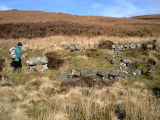
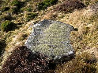
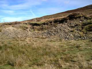
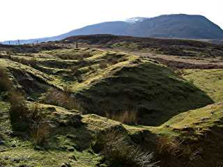
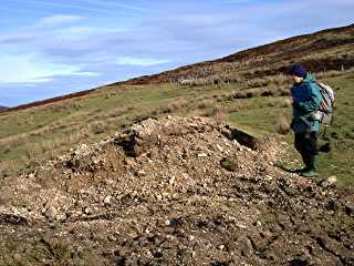
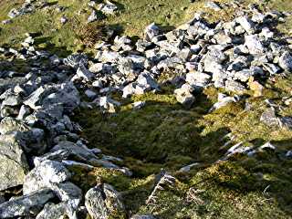
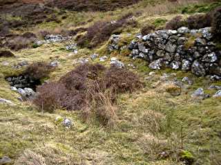
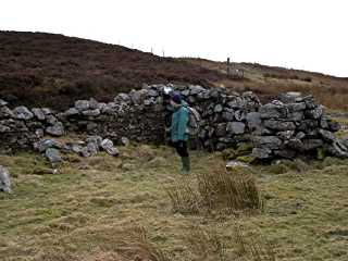
| Remains | An extensive area of worked ground on the west and north sides of Mynydd Nodol. On the west side of the hill most of the workings apear to be shallow surface excavations, although there are indications of run-in levels. On the north side of the hill, overlooking what is now Llyn Celyn, are some deeper workings, an incline and the remains of buildings.
Specific features include a small surface working with a possible bucking stone (SH85903914), remains of an ore-bin (SH86003960), a large open working leading to a deep worked-out rift with remains of a wooden ladder (SH86213979), the incline foot, an adit, tip and buildings (SH86433988) and a possible smithy (SH86293981). (February 2009) The site was surveyed in detail by RCAHMW in 2011 as part of the Atlanterra Project. |
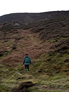
Access | With the exception of openings to the deep workings and the adit at SH86193978 which have been fenced off, the remains are on Public Access land. | ||||||||||||||||||||||||||||||||||||||||||||||
In July 1868 it was reported that “at great expense, immense veins of manganese have been searched for and found, the quality being equal, if not superior, to the foreign manganese. Samples have been submitted to Prof. Crace-Calvert and Dr. B. W. Gerland, both of whom pronounced them to contain from 70 to 75 per cent. of oxide of manganese.” [MJ 1868 p. 592].
Halse [1892: 943–946] describes in some detail an abandoned working “on the smaller hill near Arenig” following a vein at a depth of 100 feet (30m) from the surface for 250 feet (76m). Nearby, another vein was worked to 60 feet (18m) with one sample of ore having 56% manganese. A number of other workings are described including a vein of 46% manganese ore beneath old workings which was worked to a depth of 43 feet (13m) [Halse 1892: 941–942].
In 1898 it was reported that gold had been found whilst looking for manganese [MJ 1898 p. 535].In August 1905 W Bowen-Jones noted that one man was employed for one or two days in the spring cleaning the opening to an old level [GAS CAO: XD/35/420 p. 101]. In October 1906 he reports 4 to 12 men employed since the spring of that year clearing old workings and making trials for manganese [GAS CAO: XD/35/420 p. 150]. In April 1911 the Inspector notes “One man in charge of Mr Claugton’s Sett. No mining done. There are one or two dangerous holes on the lowest Sett.” [GAS CAO: XD/35/422 p. 82]
Down commented in 1980 that ore could be found in numerous small opencast workings in a myriad tiny veins [Down 1980: 51], however, there was little of this to be seen in 2009.