Dinas Oleu
| Location | SH618155 (Area map showing location.) |
|---|---|
| Parish | Llanaber |
| Owners | |
| Production and Employment | |
| Transport | |
| Remains | Large open quarry behind Last Inn, Barmouth. (March 2002) |
| Access | Can be viewed from path (public Right-of Way). |
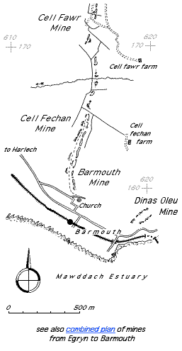
Although listed as a manganese mine [GAT SMR: 20577], this location is in the top of the Barmouth Formation which is stratigraphically above the Hafotty Formation which contains the manganese ore bed [Allen & Jackson 1985a: 50, 51]. It has the appearance of a stone quarry.
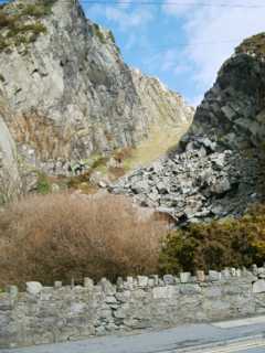 | Dinas Oleu quarry | 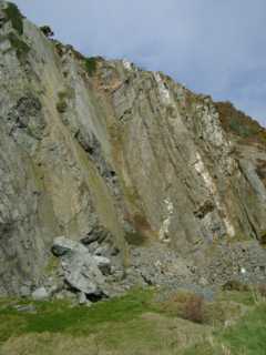 |
Dinas Oleu quarry
Higher up in the quarry. There is no obvious sign of manganese mining visible. |